
Know the land before you bid — slope, water, access, buildability.
You're evaluating parcels you've never stood on, and the surprises show up after the money's committed.
What you get
A plain-language assessment of terrain, drainage, flood exposure and access, from public elevation data.
Every parcel looks flat in a listing photograph. The seller's pictures come from the one corner where it looks level, and the drone shot is high enough that a 15 percent slope reads as a gentle rise.
We take free government survey data — flown by aircraft over whole countries and published for anyone to use — and turn it into a plain read on what the ground does. No jargon, no software to install, no site visit to pay for.
You get a short written assessment and clear maps: where it slopes, where water goes, what is buildable, and what the surprises are.
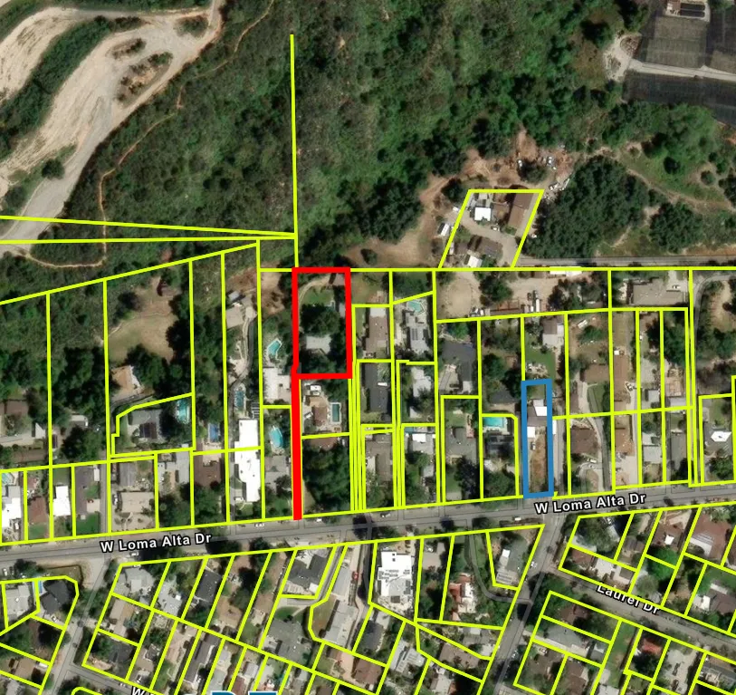
Where our work stops
A screening analysis to inform your offer, not a survey or a legal determination.
If you buy the land, you will still want a real survey before you build. This is what helps you decide whether to get that far.
What you find out
Six things that decide whether a parcel is worth your money.
How steep it is
Where the land is flat enough to build on without heavy earthworks, and where it falls away. Slope is the single biggest driver of what a build costs.
Where water goes
Which way rain runs across the plot, where it collects, and whether the low point is somewhere you were planning to put a house.
Flood exposure
Whether any part of the parcel sits in a mapped flood zone, and how high the rest of it sits above the nearest watercourse.
Access
Whether there is a road frontage, how steep the approach is, and whether reaching the buildable part means crossing the difficult part.
Tree cover
How much of the plot is under canopy, and roughly what clearing would be involved to use it.
Shape and usable area
How much of the acreage you are actually buying is usable once slope, water and setbacks are taken off.
Where this works
This depends on free public survey data — so it only works in some countries.
These governments have flown their whole territory with survey aircraft and published the results free. That data is why there is no site visit and no surveyor's day rate.
Coverage varies within countries as well as between them. Not on the list? Tell us where the land is and we will check what exists over your plot — free, and it takes minutes.
How accurate it is
Vertical accuracy is typically 10–30 cm depending on the source dataset and how much canopy sits over the site. That is good enough to plan around and nowhere near survey grade — which is the honest trade for work that needs no site visit.
| Country | Data source | Coverage |
|---|---|---|
| United States | USGS 3DEP | Near-national coverage |
| England | Environment Agency | National LiDAR Programme |
| Netherlands | AHN | National, high density |
| Denmark | Danmarks Højdemodel | National |
| Finland | NLS Finland | National |
| Canada | HRDEM / provincial | Partial — populated corridors |
| New Zealand | LINZ | Most regions |
| Australia | ELVIS / Geoscience Australia | Partial — varies by state |
Coverage is checked against your specific location before you pay anything.
First step
Send a parcel number or a pin.
We reply within 24 hours and send a full written scope within two business days.
That really is all we need
A parcel number, an address, or a pin dropped on a map. If you have the estate agent's listing, send the link and we will pull the rest ourselves.
Looking at more than one? Send them all. Comparing three side by side is usually how people find out the cheapest was cheap for a reason.
Before you ask
What buyers ask before ordering one
Is this a survey?
No. A survey is a licensed professional physically measuring your boundaries and producing a legal document. This is a desk assessment from public aerial and elevation data, to help you decide whether a parcel is worth pursuing. If you buy, you will still want a real survey.
How accurate is the ground height?
Within 10 to 30 centimetres, depending on the source data and tree cover. Enough to tell you a slope is 12 percent rather than 4; nowhere near enough to set a foundation level. Anyone offering survey-grade accuracy without visiting the site is not telling you the truth.
Can you tell me the legal boundary?
No. We show the parcel outline as it appears in public records, which is usually close. The legal boundary is determined by deeds and by a surveyor on the ground, and where the two disagree the public record is the one that is wrong.
What do you need from me?
A parcel number, an address, or a dropped pin on a map. If you have the listing link, that is usually enough on its own.
How long does it take?
Reply within 24 hours, written scope within two business days — including whether data over your specific plot exists and what it costs. If coverage is not there, we tell you instead of taking your money.
What if I am looking at several parcels?
The common case, and where this is most useful. Send them together and you get a comparison rather than isolated reports — the fastest way to eliminate the ones that were never going to work.
Also produced here
Check a parcel.
Send a parcel number or a pin.
Reply within 24 hours. Written scope within two business days.